Climate for Station: Kimchaek/Songjin, North Hamgyong, Korea, North
Loading live weather...
Climate Analysis & Overview
Kimchaek, located in North Korea, shows a warming trend with a more evenly distributed precipitation pattern over recent years. The climate data indicates a significant rise in temperatures, both in highs and lows, over the past decade, contrasting with a more modest long-term warming trend. These changes are set against the backdrop of regional climate adaptation goals.
Geographical and Climatic Context
Kimchaek, situated at coordinates 40.667, 129.2, experiences a humid continental climate, characterised by cold, dry winters and warm, wet summers. The city's proximity to the Sea of Japan (East Sea) influences its weather patterns, contributing to its distinct seasonal variations. The surrounding topography, including nearby mountains, can also impact local climate dynamics, affecting both temperature and precipitation distribution.
Temperature Trends: A Decade of Change
Over the past decade, Kimchaek has experienced a notable warming trend. The average high temperatures have increased by 1.21°C (2.18°F), while the lows have risen by 1.05°C (1.89°F). These figures suggest a significant shift towards warmer conditions, which could have implications for local ecosystems and agriculture. In contrast, the all-time trends show a more gradual warming, with highs increasing by 0.32°C (0.58°F) and lows by 0.08°C (0.14°F). This discrepancy between short-term and long-term trends highlights the importance of continued monitoring and adaptation strategies.
Precipitation Patterns: Even Distribution
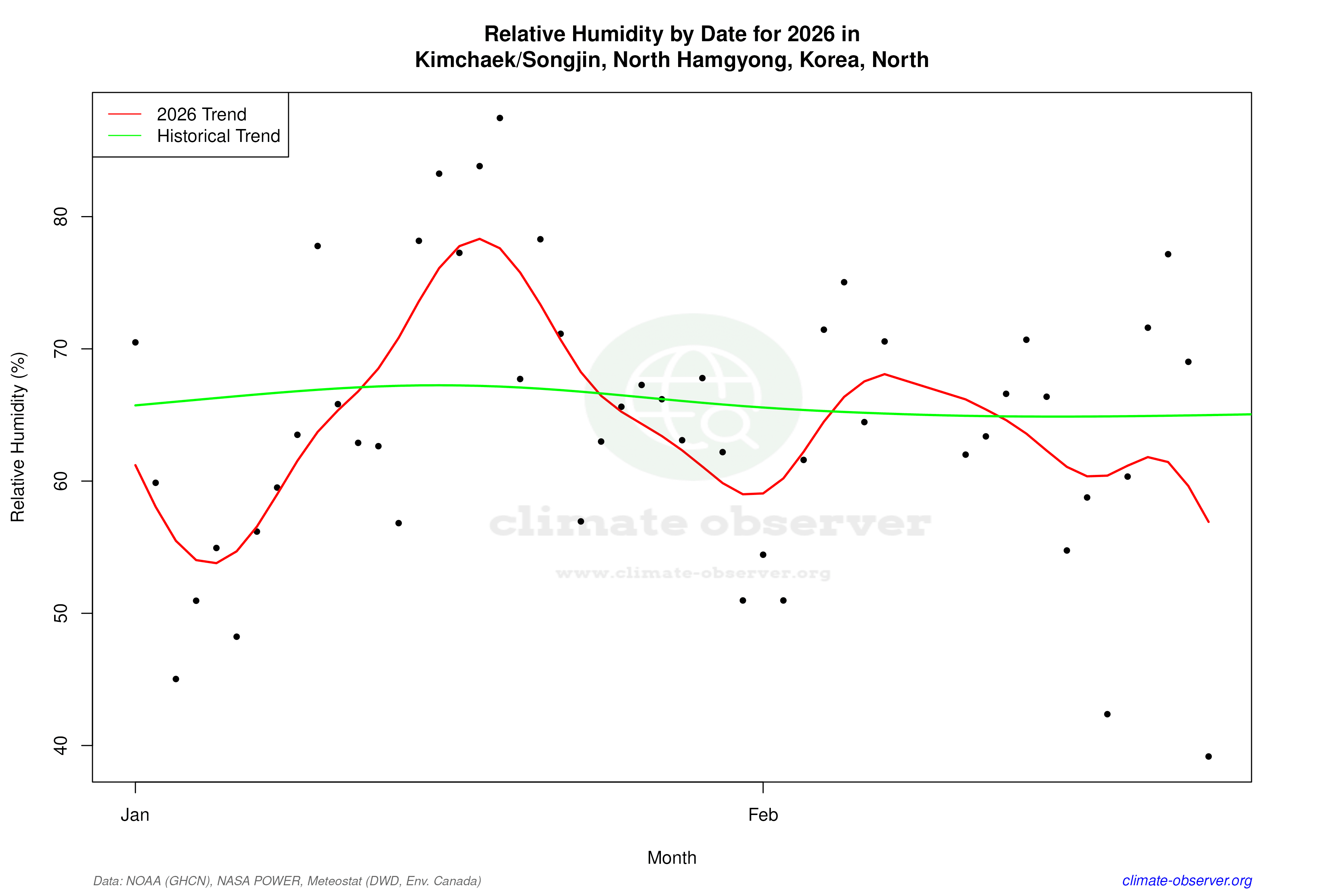
The Precipitation Concentration Index (PCI) for Kimchaek has decreased from a baseline of 16.97 to a current value of 12.95. This reduction indicates that precipitation is now more evenly distributed throughout the year, as opposed to being concentrated in fewer, more intense events. Such a shift can mitigate the risks of flooding and drought, offering a more stable water supply for agriculture and daily use. The PCI change is significant, reflecting a broader trend towards climatic stability in terms of rainfall distribution.
Temperature Extremes: Records and Realities
Kimchaek's climate data records an absolute maximum temperature of 37.0°C (98.6°F) and a minimum of -26.0°C (-14.8°F). These extremes illustrate the wide temperature range experienced in the region, a hallmark of its continental climate classification. Such variability necessitates robust infrastructure and adaptive strategies to manage both heatwaves and cold snaps effectively.
Regional Climate Goals and Implications
North Korea has been increasingly focused on climate resilience and sustainable development. The observed warming trends and changes in precipitation patterns in Kimchaek align with regional efforts to adapt to climate change impacts. These efforts include enhancing agricultural practices, improving water management systems, and investing in renewable energy sources to reduce carbon emissions. The data from Kimchaek serves as a critical input for shaping these policies and ensuring they are grounded in the latest scientific insights.
Station Statistics
10-Year Trend
High: +1.20 °C/decade
Low: +1.08 °C/decade
Rain: +0.54 mm/decade
25-Year Trend
High: +0.35 °C/decade
Low: -0.17 °C/decade
Rain: +0.36 mm/decade
50-Year Trend
High: +0.44 °C/decade
Low: +0.08 °C/decade
Rain: +0.14 mm/decade
All-Time Trend
High: +0.32 °C/decade
Low: +0.08 °C/decade
Rain: +0.14 mm/decade
Percentage Above-Average Days
Last 12 Months: 51.8%
This Year: 26.3%
Precipitation Concentration Index (PCI) ℹ️
Last 12 Months: 13.0
Historical Average: 18.0
Percentile Rank of Last 12 Months ℹ️
High: 82nd percentile
Low: 74th percentile
Rain: 53rd percentile
Change in Variance ℹ️
High: +3.3%
Low: +9.8%
Intraday: -13.9%
Data Coverage
88.1%
First Year of Data
1957
Station Location
Historical Weather Records
| Max High | Avg High | Min High | Max Avg | Avg Avg | Min Avg | Max Low | Avg Low | Min Low | Max Precipitation | Avg Precipitation | Max Snow | Avg Snow | |
|---|---|---|---|---|---|---|---|---|---|---|---|---|---|
| Record | 37.0 °C | — | -12.8 °C | 29.4 °C | — | -16.7 °C | 25.8 °C | — | -26.0 °C | 236.0 mm | — | — | — |
| January | 14.0 °C | 1.0 °C | -12.8 °C | 5.1 °C | -3.9 °C | -16.7 °C | 3.6 °C | -7.9 °C | -26.0 °C | 21.2 mm | 0.6 mm | — | — |
| February | 16.7 °C | 2.3 °C | -8.3 °C | 8.5 °C | -2.1 °C | -13.9 °C | 3.8 °C | -6.1 °C | -20.0 °C | 30.0 mm | 0.6 mm | — | — |
| March | 27.8 °C | 6.9 °C | -6.0 °C | 16.2 °C | 2.5 °C | -10.8 °C | 7.5 °C | -1.4 °C | -15.0 °C | 29.8 mm | 0.7 mm | — | — |
| April | 35.2 °C | 13.0 °C | 0.0 °C | 21.7 °C | 8.0 °C | -2.5 °C | 13.8 °C | 3.8 °C | -7.1 °C | 56.9 mm | 1.4 mm | — | — |
| May | 34.0 °C | 17.6 °C | 6.1 °C | 23.8 °C | 12.6 °C | 3.9 °C | 16.1 °C | 8.9 °C | -0.5 °C | 79.0 mm | 1.9 mm | — | — |
| June | 35.0 °C | 20.4 °C | 10.4 °C | 27.2 °C | 16.6 °C | 9.0 °C | 22.5 °C | 14.0 °C | 1.0 °C | 138.9 mm | 2.5 mm | — | — |
| July | 37.0 °C | 24.1 °C | 14.1 °C | 29.4 °C | 20.8 °C | 12.7 °C | 25.2 °C | 18.5 °C | 9.0 °C | 236.0 mm | 5.3 mm | — | — |
| August | 36.6 °C | 25.8 °C | 17.9 °C | 29.1 °C | 22.4 °C | 15.0 °C | 25.8 °C | 19.8 °C | 10.6 °C | 159.0 mm | 5.2 mm | — | — |
| September | 32.9 °C | 22.7 °C | 13.6 °C | 26.9 °C | 18.5 °C | 9.6 °C | 23.5 °C | 15.0 °C | 2.8 °C | 207.8 mm | 2.7 mm | — | — |
| October | 30.2 °C | 17.5 °C | 4.5 °C | 22.1 °C | 12.4 °C | 0.3 °C | 18.9 °C | 8.0 °C | -4.0 °C | 84.5 mm | 1.2 mm | — | — |
| November | 23.7 °C | 10.2 °C | -5.0 °C | 15.8 °C | 5.2 °C | -10.4 °C | 12.6 °C | 1.3 °C | -16.6 °C | 53.5 mm | 1.3 mm | — | — |
| December | 17.8 °C | 3.6 °C | -10.1 °C | 9.4 °C | -1.3 °C | -14.4 °C | 7.7 °C | -5.1 °C | -25.1 °C | 23.9 mm | 0.8 mm | — | — |
Data Visualisations
Remove WatermarksCurrent Year Climate Trends vs Historical


Max Temperature this Year | 1 of 6
Climate 12-Month Moving Averages


Max Temperature 12-Month MA | 1 of 6
Daily Data Points and Averages Throughout the Year


Average Max Temperature Throughout Year | 1 of 5
