Climate for Station: Laghouat, Algeria
Loading live weather...
Climate Analysis & Overview
Laghouat, located in Algeria, is experiencing a warming trend, with recent data indicating a significant increase in both high and low temperatures over the past decade. The region's precipitation has become more evenly distributed, reflecting a decrease in the Precipitation Concentration Index. These changes align with Algeria's climate adaptation goals, which aim to address the impacts of climate change on local environments.
Desert Climate Dynamics
Laghouat, situated at 33.7997, 2.89 within the Algerian Sahara, falls under the BWh classification of the Köppen climate system, indicating a hot desert climate. This region is characterised by extremely high temperatures during summer and cooler winters, influenced by its geographic position away from moderating bodies of water and surrounded by arid landscapes. The all-time temperature trends reveal a slight warming, with highs increasing by 0.04°C (0.07°F) and lows by 0.16°C (0.29°F). This warming trend, although modest over the long term, is more pronounced when examining the past decade.
Decadal Temperature Surge
In the last ten years, Laghouat has experienced a notable increase in temperature extremes. Highs have risen by 1.43°C (2.57°F), while lows have increased by 1.17°C (2.11°F). This sharp rise suggests a significant shift in the region's climate, potentially exacerbating the challenges of living in an already harsh environment. Such temperature increases can lead to more frequent heatwaves, stressing both natural ecosystems and human infrastructure.
Precipitation Patterns and PCI
The Precipitation Concentration Index (PCI) measures how precipitation is distributed throughout the year. A decrease in PCI from a baseline of 16.5 to the current 13.9 indicates that rainfall in Laghouat has become more evenly distributed. This change suggests a shift towards less concentrated, more regular precipitation events, which could be beneficial for agriculture and water management in this arid region. A PCI under 20 implies that rainfall is not highly concentrated, reducing the risk of flash floods and allowing for better water absorption into the soil.
Temperature Extremes and Records
Laghouat's climate is marked by extreme temperatures, with a record high of 49.0°C (120.2°F) and a chilling low of -11.0°C (12.2°F). These extremes highlight the variability and harshness of the desert climate. The ability to withstand such temperature swings is crucial for the resilience of both human and ecological systems in the area.
Regional Climate Goals and Adaptation
Algeria's climate strategy focuses on adaptation and resilience, aiming to mitigate the impacts of climate change on its diverse environments. The observed warming trends and changes in precipitation patterns in Laghouat underscore the importance of these goals. By understanding and adapting to these shifts, the region can better prepare for future climate variability and its associated challenges.
Station Statistics
10-Year Trend
High: +2.08 °F/decade
Low: +2.22 °F/decade
Rain: -0.001 in/decade
25-Year Trend
High: +1.30 °F/decade
Low: +1.71 °F/decade
Rain: -0.004 in/decade
50-Year Trend
High: +0.91 °F/decade
Low: +1.06 °F/decade
Rain: -0.002 in/decade
All-Time Trend
High: +0.06 °F/decade
Low: +0.29 °F/decade
Rain: -0.000 in/decade
Percentage Above-Average Days
Last 12 Months: 51.0%
This Year: 58.7%
Precipitation Concentration Index (PCI) ℹ️
Last 12 Months: 14.7
Historical Average: 17.0
Percentile Rank of Last 12 Months ℹ️
High: 78th percentile
Low: 97th percentile
Rain: 44th percentile
Change in Variance ℹ️
High: -1.6%
Low: +20.6%
Intraday: -23.7%
Data Coverage
56.2%
First Year of Data
2011
Station Location
Historical Weather Records
| Max High | Avg High | Min High | Max Avg | Avg Avg | Min Avg | Max Low | Avg Low | Min Low | Max Precipitation | Avg Precipitation | Max Snow | Avg Snow | |
|---|---|---|---|---|---|---|---|---|---|---|---|---|---|
| Record | 120.20 °F | — | 28.40 °F | 102.38 °F | — | 30.02 °F | 89.60 °F | — | 12.20 °F | 1.89 in | — | — | — |
| January | 78.98 °F | 57.10 °F | 28.40 °F | 64.94 °F | 45.72 °F | 31.28 °F | 58.46 °F | 34.87 °F | 15.80 °F | 1.11 in | 0.02 in | — | — |
| February | 84.20 °F | 61.47 °F | 36.95 °F | 69.44 °F | 49.42 °F | 30.78 °F | 60.98 °F | 37.47 °F | 23.00 °F | 0.91 in | 0.01 in | — | — |
| March | 91.40 °F | 67.60 °F | 42.80 °F | 75.92 °F | 55.54 °F | 35.71 °F | 62.60 °F | 42.40 °F | 22.71 °F | 1.22 in | 0.02 in | — | — |
| April | 98.60 °F | 74.65 °F | 49.73 °F | 87.80 °F | 62.49 °F | 43.57 °F | 70.52 °F | 48.01 °F | 28.40 °F | 1.58 in | 0.02 in | — | — |
| May | 106.56 °F | 83.34 °F | 54.55 °F | 93.02 °F | 71.70 °F | 48.38 °F | 80.60 °F | 56.07 °F | 32.00 °F | 1.61 in | 0.02 in | — | — |
| June | 111.38 °F | 93.86 °F | 64.40 °F | 99.86 °F | 81.97 °F | 59.18 °F | 89.60 °F | 65.52 °F | 35.60 °F | 1.89 in | 0.01 in | — | — |
| July | 120.20 °F | 101.21 °F | 77.00 °F | 102.38 °F | 88.54 °F | 70.39 °F | 87.80 °F | 71.62 °F | 48.20 °F | 1.13 in | 0.01 in | — | — |
| August | 114.80 °F | 99.74 °F | 75.20 °F | 99.68 °F | 86.95 °F | 68.72 °F | 89.60 °F | 70.69 °F | 50.00 °F | 0.62 in | 0.01 in | — | — |
| September | 107.60 °F | 89.58 °F | 62.60 °F | 94.64 °F | 77.45 °F | 57.87 °F | 82.40 °F | 63.24 °F | 44.60 °F | 1.65 in | 0.03 in | — | — |
| October | 104.00 °F | 77.98 °F | 44.60 °F | 85.46 °F | 66.24 °F | 46.94 °F | 72.14 °F | 53.40 °F | 33.80 °F | 1.83 in | 0.02 in | — | — |
| November | 86.18 °F | 65.71 °F | 40.77 °F | 74.12 °F | 54.56 °F | 36.12 °F | 64.40 °F | 43.44 °F | 23.00 °F | 1.38 in | 0.02 in | — | — |
| December | 82.40 °F | 58.57 °F | 36.14 °F | 64.94 °F | 47.39 °F | 30.02 °F | 60.80 °F | 36.94 °F | 12.20 °F | 1.09 in | 0.02 in | — | — |
Data Visualisations
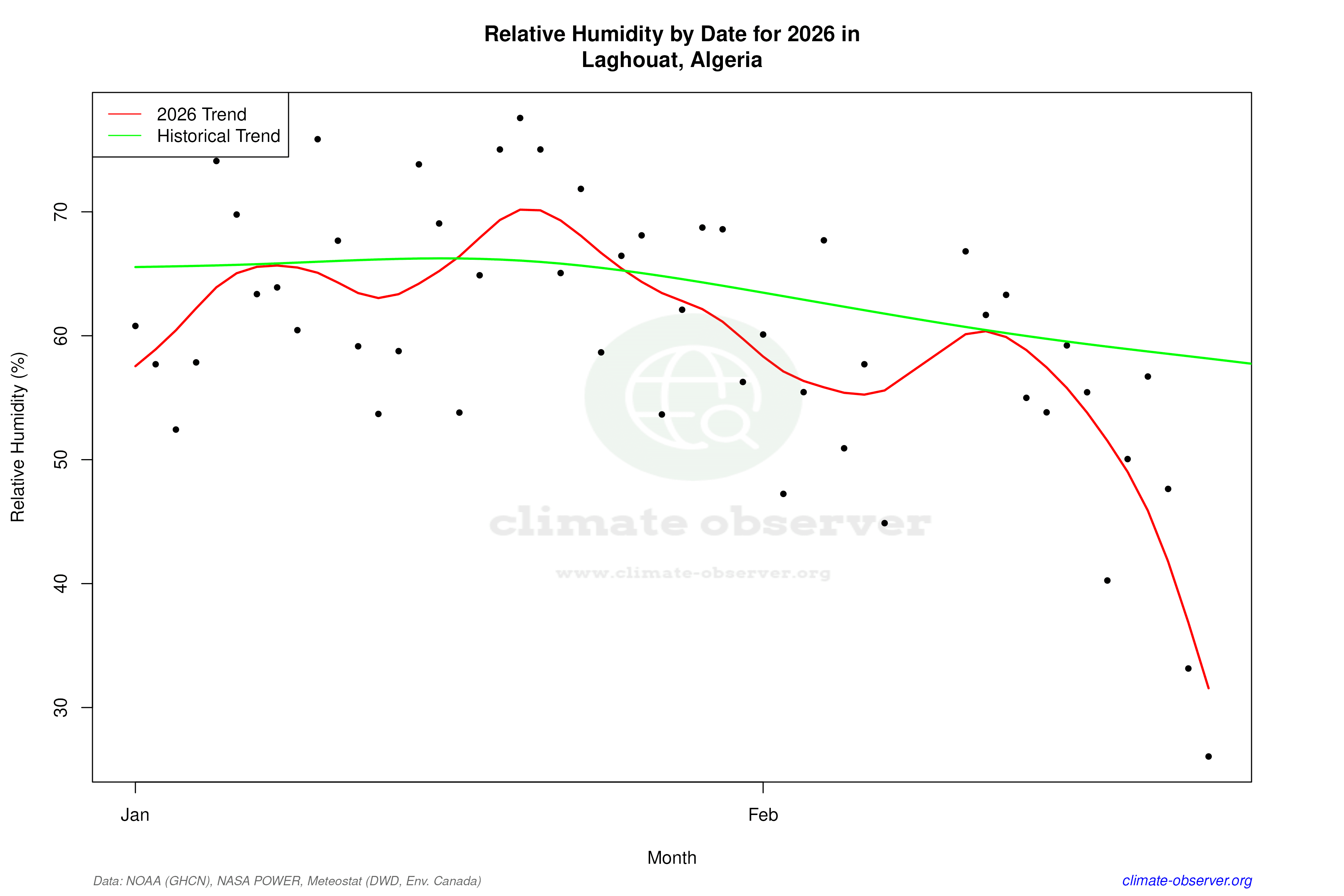
Remove WatermarksCurrent Year Climate Trends vs Historical


Max Temperature this Year | 1 of 6
Climate 12-Month Moving Averages


Max Temperature 12-Month MA | 1 of 6
Daily Data Points and Averages Throughout the Year


Average Max Temperature Throughout Year | 1 of 5
