Climate for Station: Murtala Muhammed, Lagos, Nigeria
Loading live weather...
Climate Analysis & Overview
Murtala Muhammed International Airport in Lagos, Nigeria, is experiencing a notable warming trend, with highs increasing by 0.99°C (1.78°F) over the long term. Recent trends show an even sharper rise, suggesting an acceleration in warming. Meanwhile, precipitation has become more evenly distributed, reflecting a shift in rainfall patterns.
Tropical Climate Dynamics
Murtala Muhammed International Airport is situated in Lagos, Nigeria, a region classified under the Köppen climate system as tropical savanna (Aw). This classification indicates a distinct wet and dry season, influenced by its proximity to the Atlantic Ocean. The local geography, with its coastal location, plays a significant role in moderating temperatures and influencing precipitation patterns.
Warming Trends: A Closer Look
Over the past decade, the airport has experienced a pronounced warming trend, with high temperatures rising by 1.23°C (2.21°F). This is a more rapid increase compared to the all-time trend of 0.99°C (1.78°F). The lows have also risen, albeit more modestly, by 0.23°C (0.41°F) over the past ten years, compared to a marginal all-time increase of 0.03°C (0.05°F). This suggests that while both highs and lows are warming, the daytime temperatures are accelerating more swiftly.
Precipitation Patterns: More Evenly Distributed
The Precipitation Concentration Index (PCI), which measures the distribution of rainfall over time, has decreased from a baseline of 14.44 to a current value of 10.25. This reduction indicates that rainfall events have become more evenly distributed throughout the year, as opposed to being concentrated in fewer, more intense events. Such a shift could have implications for water management and agriculture, potentially reducing the risk of flooding while ensuring more consistent water availability.
Temperature Extremes: Records and Implications
The airport has recorded an absolute maximum temperature of 40.0°C (104.0°F) and a minimum of 15.17°C (59.31°F). These extremes highlight the variability within the tropical savanna climate, where high temperatures can be intense, but cooler nights offer some respite. Such extremes are critical for understanding the potential impacts on infrastructure, health, and energy consumption in the region.
Regional Climate Goals and Context
Nigeria has been actively working towards regional climate goals, focusing on reducing emissions and enhancing resilience to climate change. The observed trends at Murtala Muhammed International Airport provide a microcosm of broader climatic shifts that could influence policy and adaptation strategies. Recent weather events, such as increased rainfall variability, underscore the need for robust climate action to mitigate potential adverse impacts on the local and national scale.
Station Statistics
10-Year Trend
High: +1.77 °F/decade
Low: +0.67 °F/decade
Rain: -0.017 in/decade
25-Year Trend
High: +2.66 °F/decade
Low: -0.20 °F/decade
Rain: -0.004 in/decade
50-Year Trend
High: +1.80 °F/decade
Low: +0.08 °F/decade
Rain: +0.006 in/decade
All-Time Trend
High: +1.80 °F/decade
Low: +0.08 °F/decade
Rain: +0.006 in/decade
Percentage Above-Average Days
Last 12 Months: 77.3%
This Year: 92.6%
Precipitation Concentration Index (PCI) ℹ️
Last 12 Months: 15.0
Historical Average: 14.2
Percentile Rank of Last 12 Months ℹ️
High: 84th percentile
Low: 86th percentile
Rain: 29th percentile
Change in Variance ℹ️
High: +28.1%
Low: +7.1%
Intraday: +16.5%
Data Coverage
85.4%
First Year of Data
1973
Station Location
Historical Weather Records
| Max High | Avg High | Min High | Max Avg | Avg Avg | Min Avg | Max Low | Avg Low | Min Low | Max Precipitation | Avg Precipitation | Max Snow | Avg Snow | |
|---|---|---|---|---|---|---|---|---|---|---|---|---|---|
| Record | 104.00 °F | — | 74.95 °F | 92.30 °F | — | 70.02 °F | 82.40 °F | — | 59.31 °F | 10.65 in | — | — | — |
| January | 104.00 °F | 88.85 °F | 77.63 °F | 89.42 °F | 80.88 °F | 70.02 °F | 80.60 °F | 74.24 °F | 59.31 °F | 0.83 in | 0.02 in | — | — |
| February | 100.04 °F | 89.37 °F | 79.83 °F | 91.76 °F | 82.36 °F | 75.02 °F | 82.40 °F | 76.77 °F | 65.44 °F | 3.60 in | 0.05 in | — | — |
| March | 100.40 °F | 88.60 °F | 80.62 °F | 92.30 °F | 82.79 °F | 76.10 °F | 82.40 °F | 78.09 °F | 68.00 °F | 2.38 in | 0.10 in | — | — |
| April | 103.28 °F | 87.58 °F | 80.17 °F | 91.76 °F | 82.36 °F | 75.20 °F | 82.40 °F | 77.94 °F | 68.00 °F | 2.40 in | 0.17 in | — | — |
| May | 98.60 °F | 86.41 °F | 77.72 °F | 91.76 °F | 81.32 °F | 74.84 °F | 81.57 °F | 77.04 °F | 68.00 °F | 7.11 in | 0.24 in | — | — |
| June | 99.68 °F | 83.90 °F | 77.18 °F | 84.92 °F | 79.21 °F | 72.86 °F | 79.50 °F | 75.53 °F | 68.00 °F | 7.10 in | 0.35 in | — | — |
| July | 91.76 °F | 82.13 °F | 74.95 °F | 83.66 °F | 77.60 °F | 72.14 °F | 77.04 °F | 74.06 °F | 67.82 °F | 10.65 in | 0.27 in | — | — |
| August | 91.40 °F | 81.95 °F | 75.42 °F | 82.76 °F | 77.09 °F | 72.18 °F | 77.00 °F | 73.49 °F | 68.00 °F | 3.37 in | 0.15 in | — | — |
| September | 93.20 °F | 82.63 °F | 76.24 °F | 83.84 °F | 77.75 °F | 73.22 °F | 77.02 °F | 74.16 °F | 66.92 °F | 3.93 in | 0.27 in | — | — |
| October | 95.00 °F | 84.45 °F | 76.91 °F | 88.34 °F | 79.16 °F | 71.60 °F | 77.94 °F | 75.04 °F | 68.00 °F | 5.15 in | 0.24 in | — | — |
| November | 101.30 °F | 86.94 °F | 79.07 °F | 91.22 °F | 80.84 °F | 74.84 °F | 79.74 °F | 76.00 °F | 65.30 °F | 1.85 in | 0.07 in | — | — |
| December | 100.40 °F | 88.37 °F | 76.41 °F | 88.88 °F | 81.01 °F | 72.68 °F | 80.60 °F | 74.94 °F | 61.88 °F | 0.83 in | 0.03 in | — | — |
Data Visualisations
Remove WatermarksCurrent Year Climate Trends vs Historical


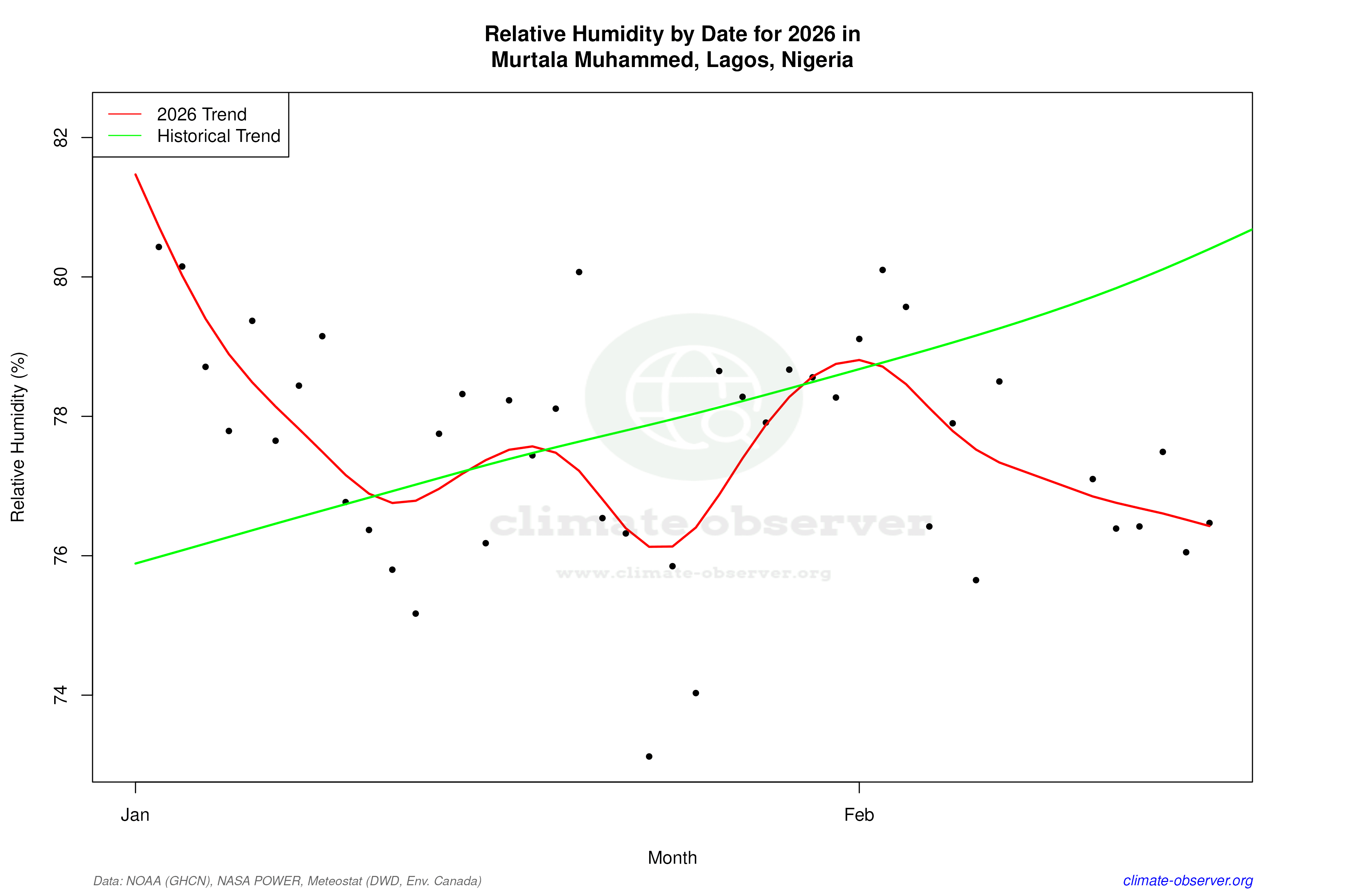

Max Temperature this Year | 1 of 6
Climate 12-Month Moving Averages


Max Temperature 12-Month MA | 1 of 6
Daily Data Points and Averages Throughout the Year


Average Max Temperature Throughout Year | 1 of 5
